January 30, 2012
The Spatial Portal focuses on where a chosen species was located, what species were found in a defined area and what are the environmental conditions in that area.
The Spatial Portal combines three basic data types – species, areas, layers and facets – to provide a suite of powerful visualisation and analysis tools. Species can also include assemblages of species or high taxa (genus, family etc) as a single mapped layer. Areas can be defined by 14 different options including digitizing on screen to importing. ‘Layers’ refer to either environmental (gridded structure with continuous values such as temperature) or contextual (polygonal areas with class values such as a land use layer with a forestry land-use class) geographic data that can be thought of as a layer draped over the map; commonly used in Geographic Information Systems (GIS).
You will soon be also be able to map occurrences of species based on an associated facet such as the institutional provider or the record type (specimen or human observation for example).
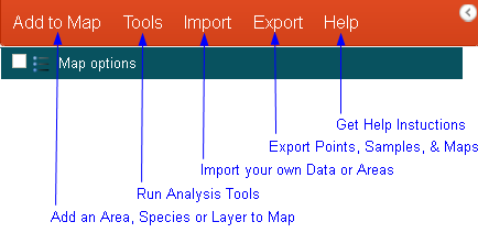
Tabs and their functions
Summary of the Functionality
- Define areas of interest on the map in many different ways including address lookup, defining environmental envelopes and drawing polygons on a map More info »
- Map and list all occurrences of one, many or all species within an area (limits apply) More info »
- Map environmental (gridded) and contextual (polygonal) data layers More info »
- Map named geographic features using the ALA gazetteer services More info »
- Find geographic features using the ALA gazetteer services nearest to a point More info »
- Create an area report summarising the information held by the Atlas for an area More info »
- Produce species lists for a chosen area More info »
- Sample environmental and contextual data together with species occurrences More info »
- Predict where a species could occur More info »
- Produce a scatterplot to visualise the relationship between species occurrence points on the map and the underlying environmental variables More info »
- Classify an area into environmental domains (areas of similar environmentl profiles) based to groups multiple environmental layers More info »
- Generate gridded data from point occurrences. For example, generate species richness and occurrence density from a species assemblage. More info »
- Add layers to a map and interact with the layers More info »
- Use the map interaction tools to manipulate the map More info »
- Change the style of the base map and save and print maps for offline analysis (png or pdf) More info »
Spatial Portal Example Screenshots
These screenshots should give you a indication of what the portal can do:
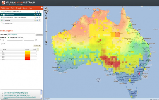
Example Layers Added to Map
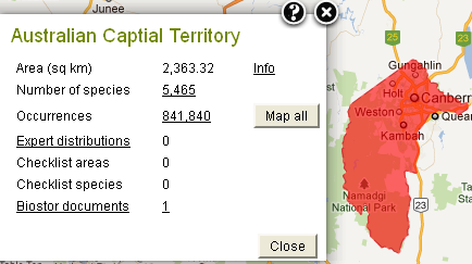
Area Report, this gives the option to download data for an area of interest, by clicking on any hyperlinked information.
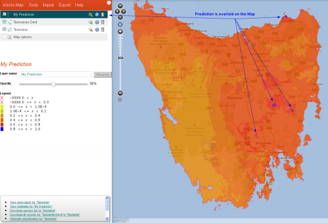
Prediction of where the Tasmanian Devil could occur based on chosen environmental layers and contextual layers
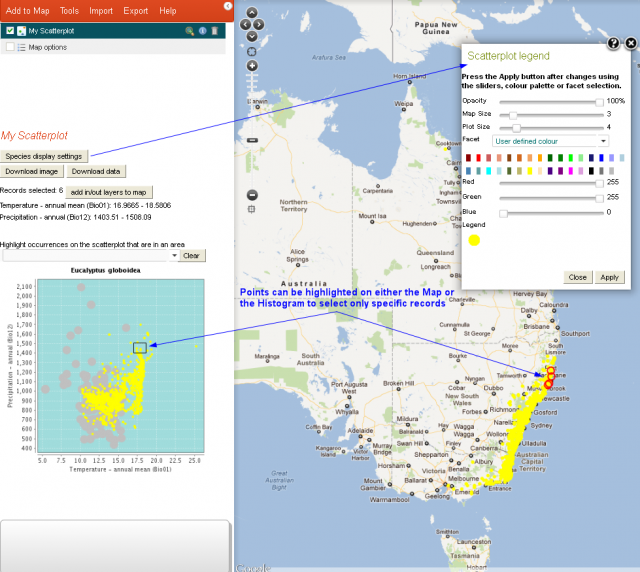
A scatterplot of the Eucalyptus globidea plotted against two different environment variables.
In this example we have also shown that you can also manipulate the display settings and faceting options using the ‘Species display settings’ button. You can also download the image and the data using the buttons located on the left hand side.
Saving your session
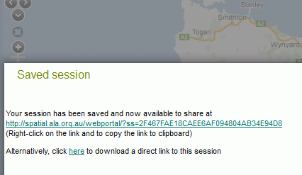
When you are logged into the Atlas, you can save your session. If you have completed an extensive analysis or just a display of a suite of species and layers, you can save your session and share the Session ID with anyone. Anyone with the ID can enter it and restore the status of the layers mapped.

Clicking Save Session will bring up a window with the Session information and the ID-
